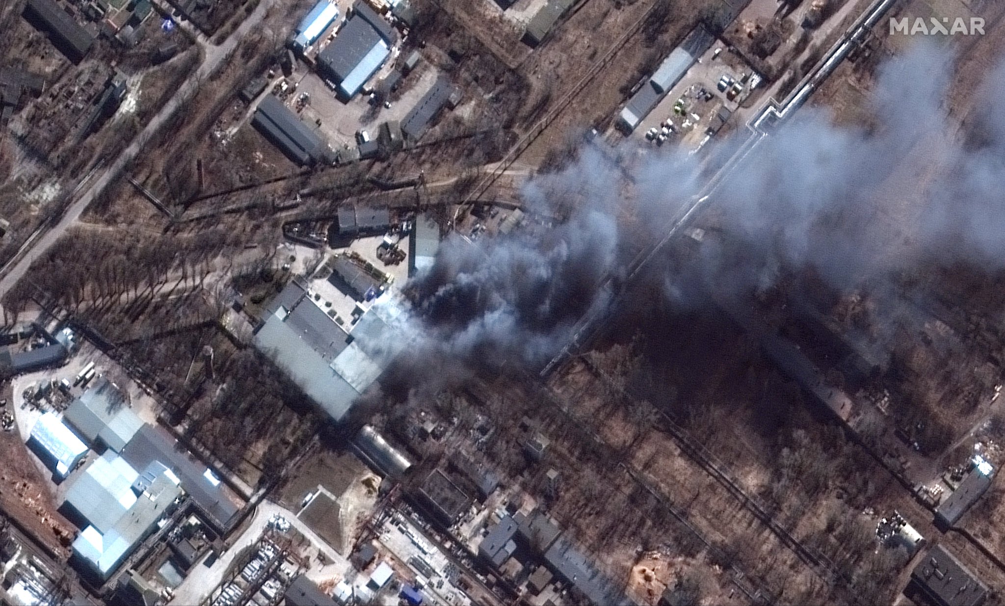
GeoConfirmed. "Satellite imagery from @Maxar shows a fire bellowing from Chernihiv's industrial area in the south after attacks targeting the area on March 10." 51.462766, 31.257669 GeoLocated by @Cen4infoRes #UkraineInvasion
#UkraineRussianWar
Satellite imagery shows fire in Chernihiv industrial area after attack
Leave a Reply