
Satellite imagery from March 23 shows the only route out of the besieged city of Chernihiv, the bridge across the Desna river [51.457311, 31.301379] has been destroyed
Satellite imagery: Desna Bridge near Chernihiv destroyed
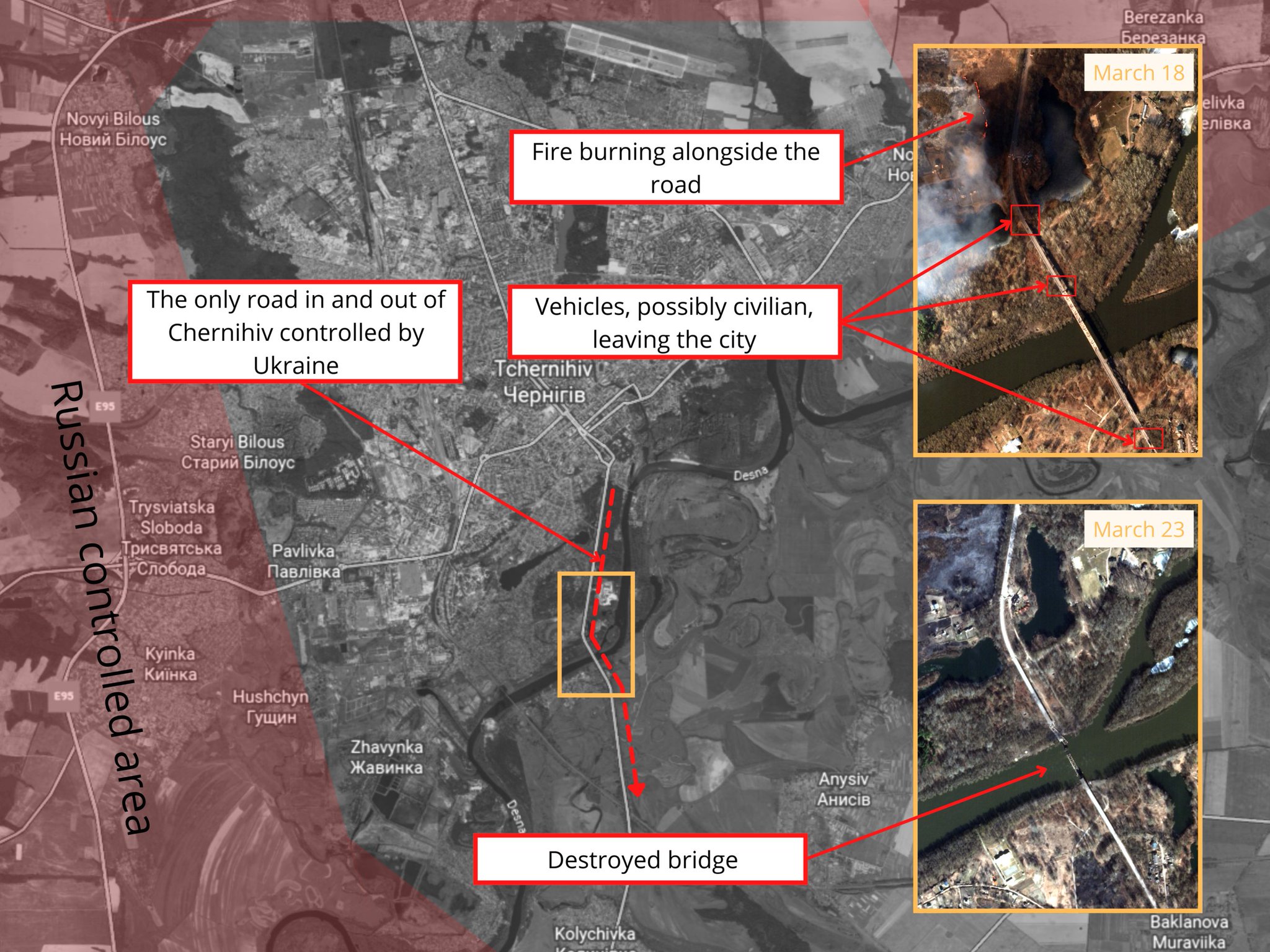
Satellite imagery from March 23 shows the only route out of the besieged city of Chernihiv, the bridge across the Desna river [51.457311, 31.301379] has been destroyed
Leave a Reply