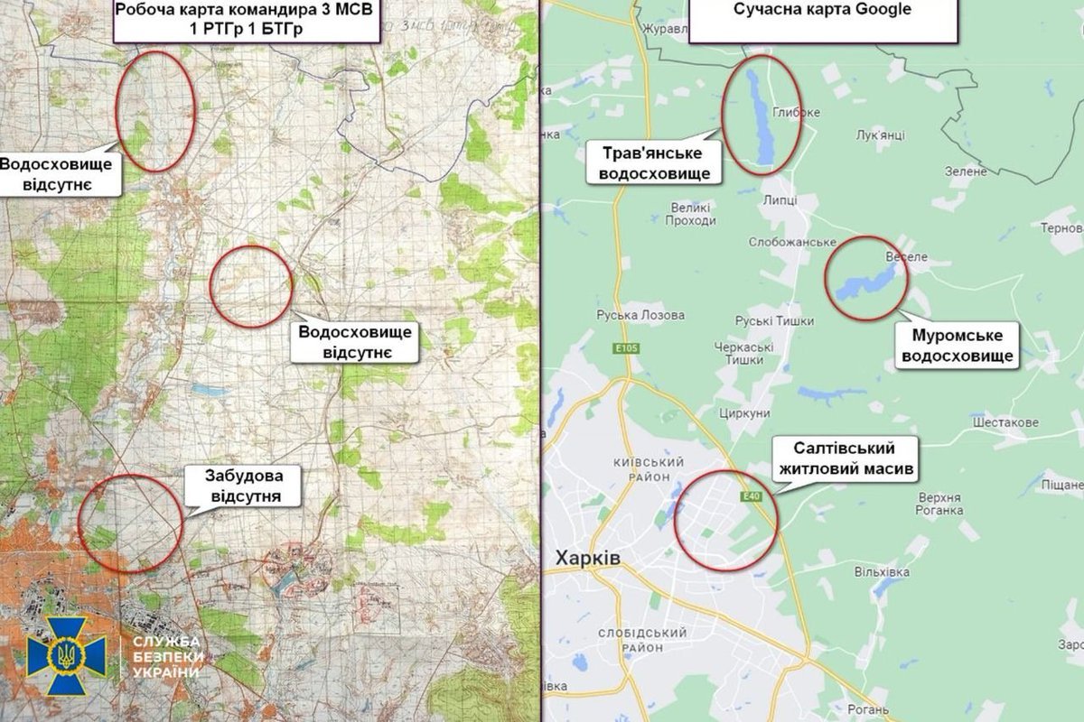
Some Russian invasion units used maps created in 1969, which lacked modern objects. Interestingly, the map, found in Kharkiv Obl, was "updated" – the Russian-Ukrainian border was marked by a line drawn by pen, Ukraine's Security Service said https://
t.me/SBUkr/4649
Russian troops used outdated 1969 maps in Ukraine, found with hand-drawn borders.
Leave a Reply