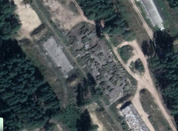
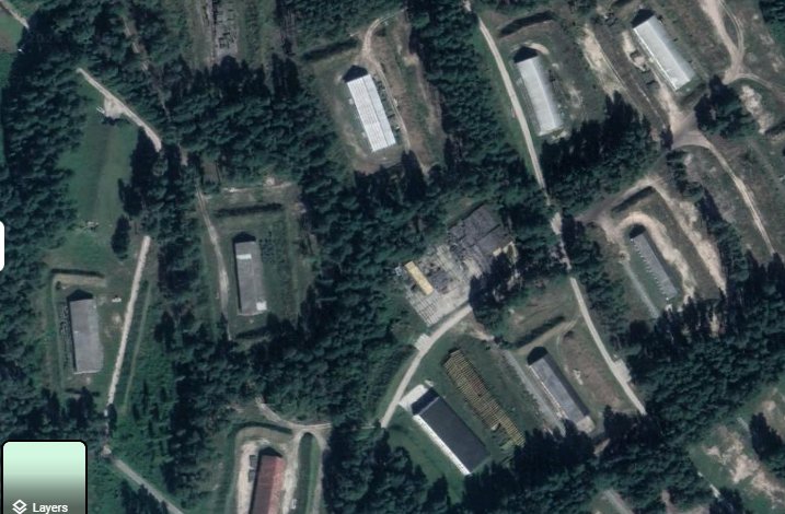
Ironically the Karachev ammo depot (
https://
google.com/maps/place/53%
C208'25.1N+3457'20.7E/@53.1407073,34.9287726,3986m/data=!3m1!1e3!4m10!1m5!3m4!2zNTPCsDA4JzI2LjAiTiAzNMKwNTcnMjQuMSJF!8m2!3d53.140546!4d34.956698!3m3!8m2!3d53.140292!4d34.955746?entry=ttu&g_ep=EgoyMDI0MTAwNS4yIKXMDSoASAFQAw
…) is marked on Google Maps as an "allotment garden" (
https://
google.com/maps/place/Sad
ovyy+Uchastok,+Bryansk+Oblast,+Russia/@53.1427789,34.9322171,3315m/data=!3m2!1e3!4b1!4m6!3m5!1s0x413283a6fde0bf49:0x1bd44ce7e2dfba5f!8m2!3d53.1425221!4d34.9523516!16sg1jkyrbp11?entry=ttu&g_ep=EgoyMDI0MTAwNS4yIKXMDSoASAFQAw
…), while the satellite imagery clearly reveals stockpiled crates and warehouses surrounded by protective berms, a setup typical of Russian-style
Leave a Reply